/ RESEARCHERS
Find local evidence in seconds.
Stop re-reading the same meta-analysis. See what's been tested near your site, and where your next trial would add the most.
Find evidence near youEvery study has a location. OpenAgData organizes four decades of field research by where it happened — so you can search by yours and find what actually works nearby, who funded it, and what no one has tested yet.
The evidence already exists. It's just not findable by the one thing that matters most — where the work was done.
A cover-crop trial in Nebraska shouldn't be buried next to one from a climate it has nothing in common with. We turn the agricultural research record into a map you can search by place and topic — so the next decision, the next RFA, the next field plan starts from evidence that actually applies.
We geolocate field trials and meta-analyses to the soils, climates, and counties where they ran — so evidence from across the road counts more than evidence across the world.
Open the mapYield, soil carbon, runoff, profit. Read what a practice actually moved, how confidently, and under which conditions — pulled into one comparable layer.
Browse researchWhere the map goes dark is where the next dollar matters most. Surface untested practices, regions, and crops — and route funding to the questions still open.
Browse open fundingPublished studies, preprints, and reports are cataloged with a link back to the source of record — we index, we don't publish.
Each study is pinned to its state and county, then tagged with funders, topics, and the outcomes it measured.
Records are grouped into research hubs and topic collections, so evidence reads as a map instead of a list.
Funders, researchers, and institutions search by place and topic to find evidence they can actually use.
Stop re-reading the same meta-analysis. See what's been tested near your site, and where your next trial would add the most.
Find evidence near youSee what your portfolio has already proven, where evidence is thin, and which regions and crops are still uncovered.
Preview portfolio intelligenceExperiment stations, extension offices, and on-farm networks — turn scattered work into one living impact report.
Become a partner hub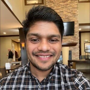
Saurav Das
Founder · OpenAgData
“A trial in Nebraska shouldn't be buried next to one from a climate it has nothing in common with.”
I'm a soil scientist. For years I watched the same thing happen: the evidence researchers and funders need already exists — it's just scattered across thousands of papers, none of them findable by the one thing that matters most: where the work was done.
So a decision-maker in the Mississippi Delta reads a meta-analysis built mostly on Midwestern soils, and a brilliant local trial sits uncited two counties over. The knowledge is there. The map isn't.
OpenAgData is my attempt to build that map — to turn the agricultural research record into something you can search by place and topic, so the next field plan, the next grant, the next policy starts from evidence that actually applies. We're early, and building in the open. If that resonates, I'd genuinely love to hear from you.
Pick a place, see what's been studied there, and find research you can actually use.